Mapping Out Renewal
This file appears in: Sandtown Neighborhood
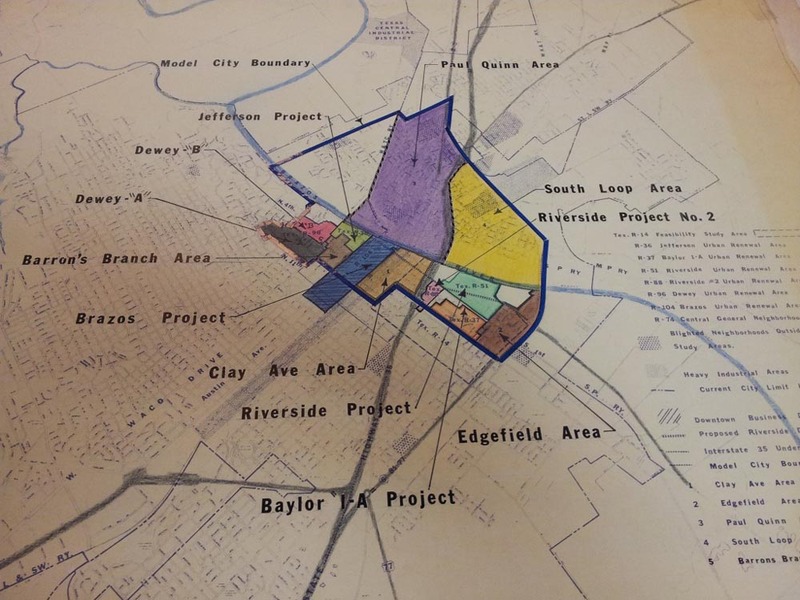
This 1970s-era Waco Urban Renewal Agency map shows an inexact representation of where the former neighborhood once stood. The area of the Sandtown included the space north of First Street (now University Parks Drive) up to the Brazos River, located inside the individual sections called Riverside and Clay Avenue Areas.
This file appears in: Sandtown Neighborhood
Sandtown Neighborhood
Sandtown was a vibrant and predominately Mexican American neighborhood that was active from the turn of the twentieth century to the 1960s. It encompassed the area of downtown Waco between Third Street and the Brazos River, and the seven blocks…
